
Last Updated on March 6, 2026 by Kristin
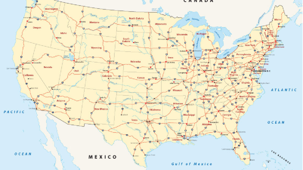
For many Americans, a long roadtrip is a summer rite of passage. These iconic car trips are possible thanks to an extensive network of freeway routes called the U.S. Highway System. Look at any roadmap map and you may just see a mess of lines at first. However, the country developed this network of roads following a set of guidelines that are still relevant all these years later.
Taking a few minutes to understand these rules of the road can be incredibly useful in case a problem arises. For example, if you hit a dead zone and your GPS fails to update, knowing how to spot a beltway may help you avoid taking a wrong turn and having to backtrack hours later.
Get to Know the US Highway System
One of the most important parts of traveling on U.S. highways is knowing the different types of highways you will encounter during your trip.
Interstate Highways
If you are traveling a long distance, it is likely you will be taking an interstate highway for much of your trip. An interstate highway, marked by a blue numbered shield sign, are part of the U.S. Interstate Highway System. These roads often (but not always) pass through several states, keeping the same number from end to end.
The interstate highway system was born in the 1950s, thanks to funding approved by then-president Dwight D. Eisenhower under the Federal-Aid Highway Act of 1956. Today, it spans nearly 47,000 miles, according to the U.S Department of Transportation’s Federal Highway Administration.
U.S. Highways
U.S. highways, sometimes called Federal Highways, are part of the United States Numbered Highway System. Since 1926, these roadways have been built and maintained by state or local governments. They are identified by black and white signs. Originally, the shield included the name of the state and the letters “U S” on a shield-shaped sign. Over time, the shield has been simplified to contain only a black route number.
State Highways
States also have their own highway system, which are denoted by varying signs. Many are black-and-white and feature the outline of that specific state. Others may have colors, like the green state route signs in California.
Understand the Highway Numbering System
One of the most important things about U.S. highways is understanding how they are numbered. The process may seem arbitrary, but the country’s roads still follow the same numbering rules developed many years ago.
Odds and evens: The most important interstate routes have one or two numbers following the letter “I” — for example, the I-90, I-80 and I-40. Odd numbers run north and south, while even numbers run east to west.
Lowest to highest: Interstate numbers reflect where they start. Interstate highways with lower numbers start in the west, and go higher as they move east. For example, I-5 is a north-south route in California, whereas I-95 is a north-south route from Miami to Maine.

Three digits: Interstate highways with three numbers can throw you for a loop — literally. These roads are known as “beltways” or “spurs,” and they take you around a city. That’s handy to know if you don’t want to drive through a metropolis.
Toll Roads in the US Highway System
While most U.S. highways are free to use, some important roads have tolls. Depending on the road, type of vehicle and how long you are traveling, the tolls could range from cents to hundreds of dollars.
Is it possible to avoid tolls on U.S. highways? In many cases you can, but it takes some planning. When you pay a toll, you are largely paying for convenience. Getting to your destination on a less-traveled route may be possible, but it could take much longer.
Note that you can use your personal E-ZPass in a rental car. You can also purchase toll tags online before a trip, such as the NC Quick Pass or any of the Texas toll tags.
Related:


